|
 Natural Environment Natural Environment
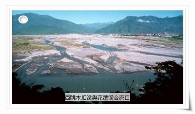
Fong Tian is located on rich sedimentary land at the convergence of 2 streams, the MuGua Stream and the Xiu Fong Stream. We are built on land from the erosion of the mountains both sides of this valley........
The rift valley was shaped by alluvial layers, which was formed in estuary by accumulation of sends and rocks brought down by upstream rivers when the Coast Mountain Ranges and Central Mountain Ranges began to .... Rivers have such alluvial rans include Mugua stream, Shofong stream (also known as ZhiYaGan stream) and MaTaiAn stream, each of which has a huge size of lmore 50 square meters.
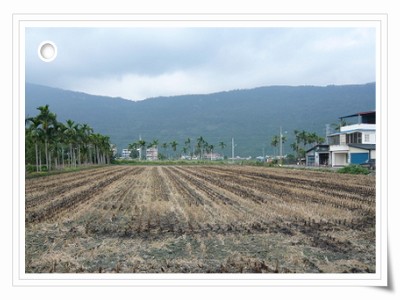
The earth of Fong Tian area is alluvial soil/ is of alluvial soil type, and with plenty of underground water. Therefore, Fong Ping village along the banks of Mu Gua stream is the one of main aquaculture zones in eastern Taiwan. Here you can see paddles, ponds, lakes and marshes. Wetlands offer the waterfowl a place to inhibit and feed, and it is easy to see many kinds of waterfowl (most of them are immigrant birds). Among the birds, the occurrence of endemic Ring-necked pheasant give the bird waters a chance to visit Fong Tian often.
The paddy landscape is also a feature of Fong Tian. The clean, clear and unpolluted environment and water has given fireflies to reproduce and given people a chance to take a glimpse at them. In spring and sumer time, butterflies and dragonflies are flying over the field, ornamenting the landscape.

| |
|
 Cultural History