|
|
|||||||||||||||||||||||||||||
 |
|||||||||||||||||||||||||||||
|
|
|||||||||||||||||||||||||||||
|
|
..........................................................................................................................................................................................................
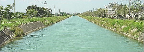
▌Main Canal, Secondary Canal, Branch Canal
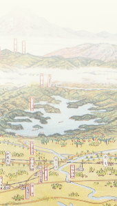
With water sources available, the next thing to consider was how to transport water to farmlands. Generally speaking, water transport was mostly facilitated by constructing canals. Chi-Nan Canal also works the same way. The irrigation canals are called water canals or simply canals.
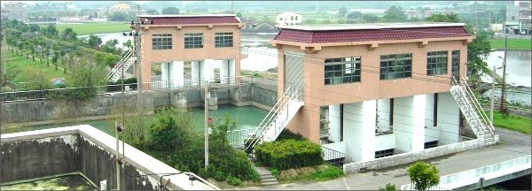
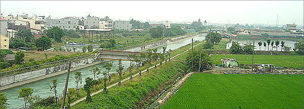
Water canals that flow from Wushantou Reservoir to the southern and northern junction
Two water gates are at the south and north junction of the main canal. The northern main canal flows upwards and the southern main canal flows downwards.
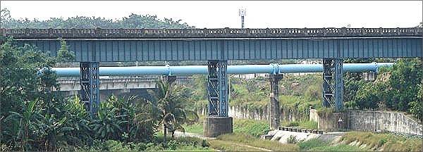
As compared to constructing reservoirs or Wushanling Tunnel, constructing a canal is a much easier task. However, due to the vast irrigation area of Chia-Nan Canal taking into consideration that water flows downwards, canal construction requires especial techniques and advanced planning. Basically, the irrigation canals are divided into: Main canal, secondary canal, Branch Canal, and field ditches etc. The main canal is the largest canal consisting of turbid main canal from Jhuoshuei River that irrigates 52,000 kah of land in the north. The southern main canal irrigates Beigang River to the south, and 56, 000 kah of farmlands of Guantian River to the north. The southern main canal, on the other hand, irrigates 42, 000 kah of farmlands of Guantian River to the south. A conduit is also buried beneath Beigang River to connect the turbid main canal and the northern main canal.
After the main canal has transported water to different areas, it divides into several secondary canals to. Beneath the secondary canals are some branch canals that slowly transport water close to farmlands. Eventually, the water flows into the field ditches right beside the farmlands. This type of water transport resembles that of tap water. Water flows from the water company, passes through large pipelines, small pipelines, and finally into houses.
After the Northern Main Canal passes through Junction Water Gate, the Southern Main Canal and the Northern Main Canal transport Water to the south and the north.
When converged into the river, iron pipes on the river transport water across the shore.
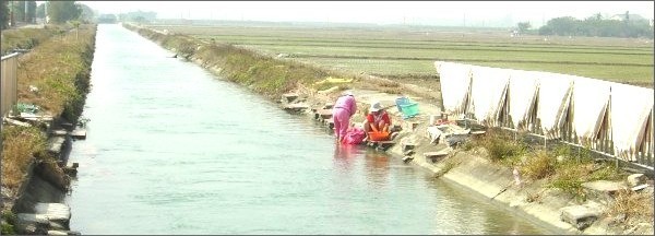
At Ansi Secondary Canal nearby Ansiliao, Houbi Township, villagers wash laundry, and blankets using water from the canal.
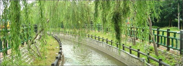
Sinying Secondary Canal passes through Sinying City Proper, so, Irrigation Association beautified the shores of the secondary canal by planting willows. It became a recreational place for the residents.
Chingliao Branch Canal is at a close range to the farmlands!
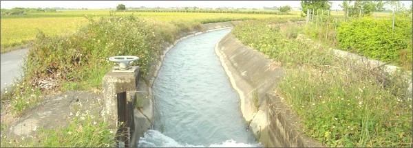
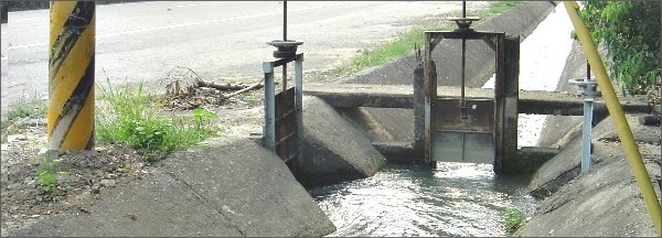
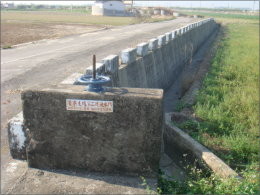
The junction gate of the canal is used to control water direction, flow. The opening and closing of the gate are controlled by the water man.
▌Actions of Water Supply Canal, Water Drainage Canal
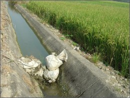
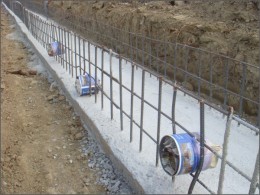
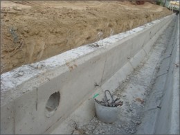
After water passes through the branch canal, it enters the field ditch. The field ditch is the smallest in size. It is located right beside the farmland. Farmers often dig an earth ditch or bury a pipeline under the rice ridges (plastic pipe or concrete pipe) to allow water to flow into the rice field. The earth ditch or pipeline is normally covered or stuffed with soil. During pilotage, water is blocked using the canal with soil bags or plywood. Then, the soil wrap or cover on the rice ridge is then removed to allow the water to flow down for irrigation.
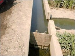
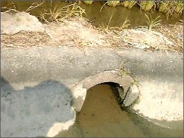
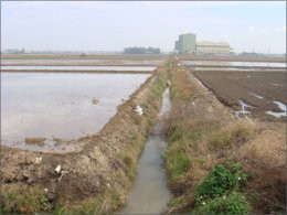
What comes around goes around. Other than the field ditches by the rice fields, there are also drainage ditches on the other end. Like the field ditch, farmers often dig earth ditches or bury pipelines on the rice ridge beside the drainage ditch. Once there is too much water in the rice field or there has been too much rain, water flows out through the ditch or pipeline. This is to prevent excessive water in the rice field that might destroy the rice seedlings. Of course, the water that flows into the drainage ditch is not lost. In Chia-Nan Canal Project, the water in the drainage ditches eventually flows to the salty lands along the coast. The high salt containing land that does not permit plant growths is immersed in this water and the salt content is released from it. Gradually, the salt content in the soil decreases, which becomes more favorable for plants.
▌Anti-flooding and Anti-Dampness Facilities
During Chia-Nan Canal designing by Hachitayoichi, he had already taken natural disasters such as flowing and high-tides into consideration. He therefore constructed anti-flooding and anti-dampness facilities in important areas. In addition, anti-flooding embankments, and anti-dampness drainage water gates were also constructed along the coast. The anti-dampness drainage water gate was setup at the meeting place between the drainage ditch and he coast. It was closed during high tides and opened to release water during low tides.
|
||||||||||||||||||||||||||||
 |
|||||||||||||||||||||||||||||
|
|
|||||||||||||||||||||||||||||
|
▍Hsin Chia Elementary School ˙Houbi Township, Tainan County , Taiwan (R.O.C.)˙2008˙1024*768 |
|||||||||||||||||||||||||||||