|
◆《Rural
villages between Hsin-Ying and Chia-Yi》
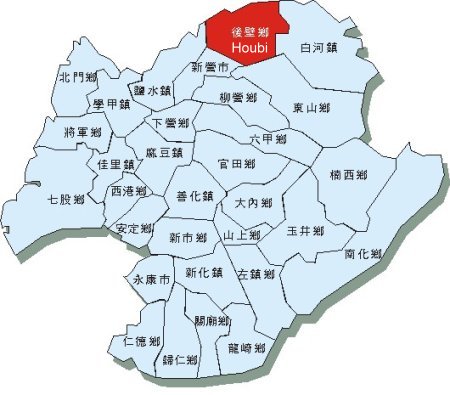
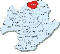 Houbi
Township is commonly known as owl-bi-liaow. Situated in the northern
end of Tainan County, the northern and western sides are bordered by
Pachang Creek and Chiayi County. It is connected to Baihe Township
in the east, Yenshui Township in the southwest, Dongshan Town in the
southeast, and Hsinying City in the south. With regard to natural
terrain form, it is elevated in the northeastern part and is tilted
toward the west. However, the relative height is not significant,
and the land form is rather flat. The territory is mostly Chianan
Plain. Geographically, Houbi Township is located at the border
between Tainan and Chiayi Metropolitan. Houbi Township is destined
to play the role of a rural village due to its location
distribution. Therefore, the humanities and landscapes of Houbi
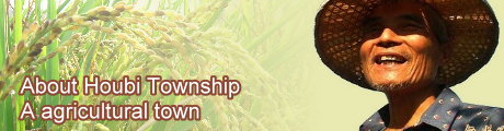
Township are apparently plain agricultural town oriented. Fields are
seen everywhere especially rice fields. In addition, commercial
activities in major villages within the precinct are rather slow. It
is especially so as compared to neighboring towns and townships. Houbi
Township is commonly known as owl-bi-liaow. Situated in the northern
end of Tainan County, the northern and western sides are bordered by
Pachang Creek and Chiayi County. It is connected to Baihe Township
in the east, Yenshui Township in the southwest, Dongshan Town in the
southeast, and Hsinying City in the south. With regard to natural
terrain form, it is elevated in the northeastern part and is tilted
toward the west. However, the relative height is not significant,
and the land form is rather flat. The territory is mostly Chianan
Plain. Geographically, Houbi Township is located at the border
between Tainan and Chiayi Metropolitan. Houbi Township is destined
to play the role of a rural village due to its location
distribution. Therefore, the humanities and landscapes of Houbi
Township are apparently plain agricultural town oriented. Fields are
seen everywhere especially rice fields. In addition, commercial
activities in major villages within the precinct are rather slow. It
is especially so as compared to neighboring towns and townships.
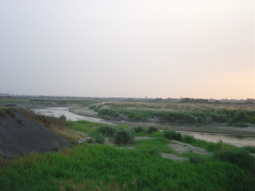
◆《Pachang
Creek in the northern vicinity》
Pachang Creek passes the northern side of
Houbi Town. Pachang Creek originated nearby Feng-Chi Lake, Alishan,
and Chiayi County. The main tributaries are Chi-Lan Creek and
Tou-Chien Creek. The many tributaries of Pachang Creek looks like a
palm, thus, the name Pachang Creek. (Meaning palm creek) It used to
be pronounced “Pachiang Creek.” Later, it was officially renamed
Pachang Creek.” Historical records show that Pachang Creek has had
several river re-channeling. It is the so-called “Snake Creek.” The
re-channeling mainly took place in middle-down stream and at sea
mouth opening. By the 80s, Water Resource Agency levied on Shi Pu
Land partially and began constructing concrete riverbanks along two
shores. River channels remained the same ever since.
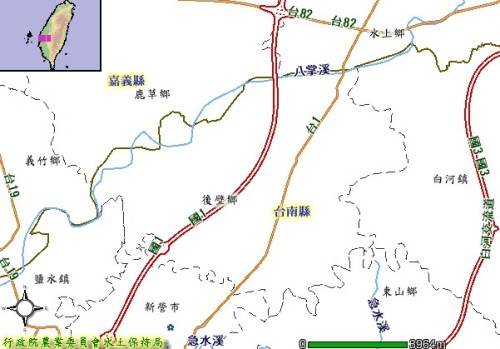
◆《Plain
terrain within the entire precinct》
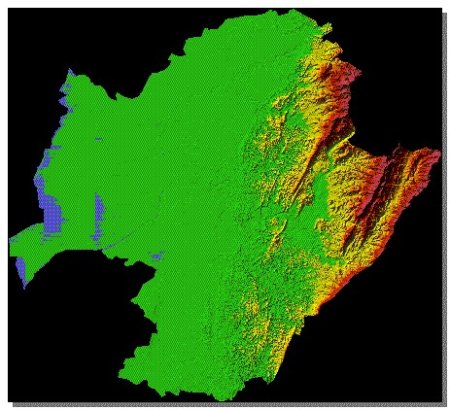
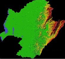 The
terrain form in Tainan County is generally classified into 3 areas:
In the Eastern mountainous area, Alishan Mountain Ridge and Blue
Ridge Mountain bordered by Zengwun River are found. It is bounded by
Chiayi Ridge in the north and Hsin-Hua Ridge in the south. The
western plain is Chia-Nan Plain. Houbi Town is located within
confines of Chia-Nan Plain. It is a narrow and long plain between
Pachang Creek and Jishuei River Jishuei River (Driving Creek)
alluvial fan. In terms of topography, the northeastern part of Houbi
Town is slightly elevated and is inclined toward the west. The
eastern boarder area measures about 30 meters and the 20-meter
contour line passes through the median line of Houbi Town. The west
of Pachang Creek is elevated 10 meters above ground. In general, the
ground gradient of Houbi Town is not steep without apparent
elevation. The terrain is relatively flat. The
terrain form in Tainan County is generally classified into 3 areas:
In the Eastern mountainous area, Alishan Mountain Ridge and Blue
Ridge Mountain bordered by Zengwun River are found. It is bounded by
Chiayi Ridge in the north and Hsin-Hua Ridge in the south. The
western plain is Chia-Nan Plain. Houbi Town is located within
confines of Chia-Nan Plain. It is a narrow and long plain between
Pachang Creek and Jishuei River Jishuei River (Driving Creek)
alluvial fan. In terms of topography, the northeastern part of Houbi
Town is slightly elevated and is inclined toward the west. The
eastern boarder area measures about 30 meters and the 20-meter
contour line passes through the median line of Houbi Town. The west
of Pachang Creek is elevated 10 meters above ground. In general, the
ground gradient of Houbi Town is not steep without apparent
elevation. The terrain is relatively flat.
|